+256-702 595 926 | info@bookgorillatracking.com

Mount Muhabura: Hiking, Location and Travel Guide

Mount Muhabura: Hiking, Location, Attractions and Travel Guide
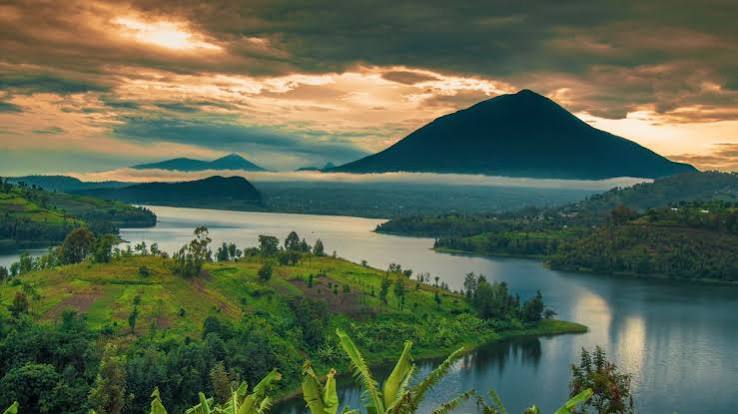
Mount Muhabura, also spelled Mount Muhavura, is one of the most impressive volcanoes in the Virunga Mountains, standing along the border between southwestern Uganda and northwestern Rwanda. Rising approximately 4,127 meters (13,540 feet) above sea level, it is the third-highest volcano in the Virunga range and a popular destination for adventurous hikers and nature enthusiasts.
Known for its steep slopes, distinctive volcanic cone, and spectacular summit views, Mount Muhabura offers a challenging hiking experience in the heart of East Africa’s volcanic landscape. The mountain is associated with Mgahinga Gorilla National Park in Uganda and Volcanoes National Park in Rwanda, two protected areas famous for mountain gorilla conservation.
For travelers interested in volcano hiking, wildlife, and scenic landscapes, Mount Muhabura is a rewarding destination to include in a Uganda or Rwanda adventure.
Where Is Mount Muhabura Located?
Mount Muhabura is located in the Virunga Mountains, a chain of volcanic mountains that stretches across Rwanda, Uganda, and the Democratic Republic of the Congo (DRC). The mountain lies on the border between Rwanda and Uganda, within a region known for its high-altitude forests, volcanic scenery, and exceptional biodiversity.
On the Ugandan side, Mount Muhabura is part of the landscape associated with Mgahinga Gorilla National Park in Kisoro District, southwestern Uganda. On the Rwandan side, it lies within the wider volcanic landscape protected by Volcanoes National Park.
Its prominent volcanic cone makes Mount Muhabura visible from surrounding areas, and its high elevation provides striking views of the neighboring volcanoes when weather conditions are favorable.
Facts About Mount Muhabura
-
Location: Rwanda–Uganda border, Virunga Mountains
-
Elevation: Approximately 4,127 meters (13,540 feet)
-
Volcanic status: Generally classified as an extinct volcano
-
Mountain type: Steep volcanic cone
-
Main activity: Guided mountain hiking
-
Nearby protected areas: Mgahinga Gorilla National Park and Volcanoes National Park
-
Notable feature: A crater lake near the summit
The name Muhabura is commonly interpreted as meaning “the guide” in the local language, reflecting the mountain’s prominence as a landmark in the region.
Hiking Mount Muhabura
Hiking Mount Muhabura is one of the most challenging volcano trekking experiences in the Virunga region. The ascent involves steep slopes, high altitude, and changing weather conditions, making good physical preparation essential.
The hike usually takes a full day, with the total duration depending on the route, weather, trail conditions, and the hiker’s pace. Visitors should arrange the hike through the relevant park authorities in Rwanda or Uganda and follow the instructions of authorized guides.
What to Expect During the Hike
-
Steep volcanic slopes: The ascent requires endurance and careful footing, particularly on the upper sections.
-
Changing vegetation: The trail passes through different vegetation zones, including montane forest and higher-altitude vegetation.
-
High-altitude conditions: Temperatures can drop considerably near the summit, and mist may reduce visibility.
-
Summit crater lake: A small crater lake is one of the mountain’s most distinctive features.
-
Panoramic views: On clear days, hikers may see the Twin Lakes of Burera and Ruhondo, neighboring Virunga volcanoes, and landscapes across Rwanda and Uganda.
How Difficult Is Mount Muhabura?
Mount Muhabura is considered a demanding hike because of its steep gradient, elevation, and the need to complete the trek within the designated hiking schedule. It is best suited to people with good general fitness who are comfortable with long uphill walks.
You do not necessarily need technical mountaineering experience, but you should be prepared for strenuous exercise at altitude. If you have concerns about your fitness or ability to cope with high elevation, seek appropriate medical advice before booking.
Top Attractions on Mount Muhabura
1. The Summit Crater Lake
One of the main highlights of Mount Muhabura is the small crater lake near its summit. This natural feature reflects the mountain’s volcanic origins and provides a memorable destination for hikers who reach the top.
Visitors should follow guide instructions around the crater and avoid entering the water unless expressly permitted by park authorities.
2. The Twin Lakes of Rwanda
The Twin Lakes, Lake Burera and Lake Ruhondo, are among the most beautiful landscapes visible from parts of the Mount Muhabura hiking route and summit when visibility is good.
Surrounded by rolling hills and green countryside, these lakes offer excellent opportunities for scenic photography. Their appearance can vary with the weather, so clear views are not guaranteed.
3. The Virunga Volcanoes
Mount Muhabura forms part of the Virunga volcanic chain, which includes several other impressive mountains, such as Mount Karisimbi, Mount Bisoke, Mount Sabyinyo, and Mount Gahinga.
Each volcano offers a different landscape and hiking experience. Travelers with additional time can consider combining a Mount Muhabura hike with other authorized outdoor activities in the region.
4. Montane Vegetation and Wildlife
The mountain’s slopes contain vegetation adapted to changing elevations and cool, moist conditions. The wider Virunga ecosystem supports a variety of birds, mammals, and primates.
Wildlife sightings during a hike are not guaranteed, and the species present vary by habitat. Visitors should remain with their guides and observe all wildlife from a safe distance.
Other Activities Near Mount Muhabura
Mount Muhabura is an excellent starting point for exploring the wider Virunga region. Depending on the country you visit and the activities available, you can include the following experiences in your itinerary.
Mountain Gorilla Trekking
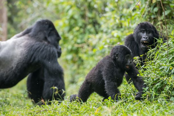
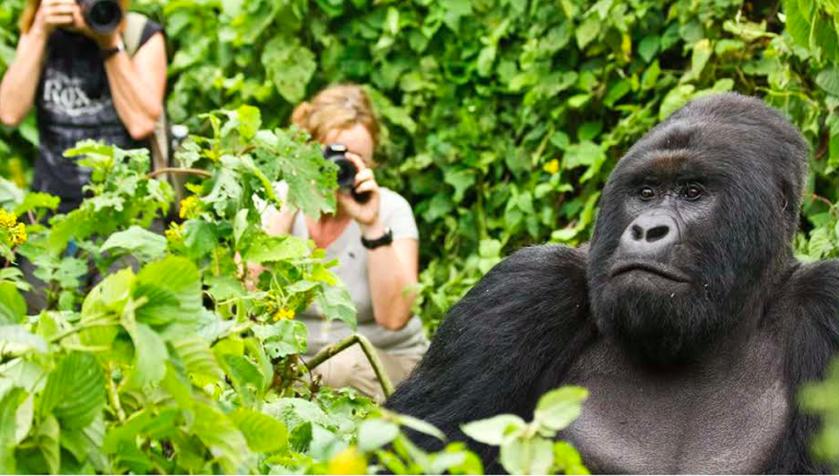
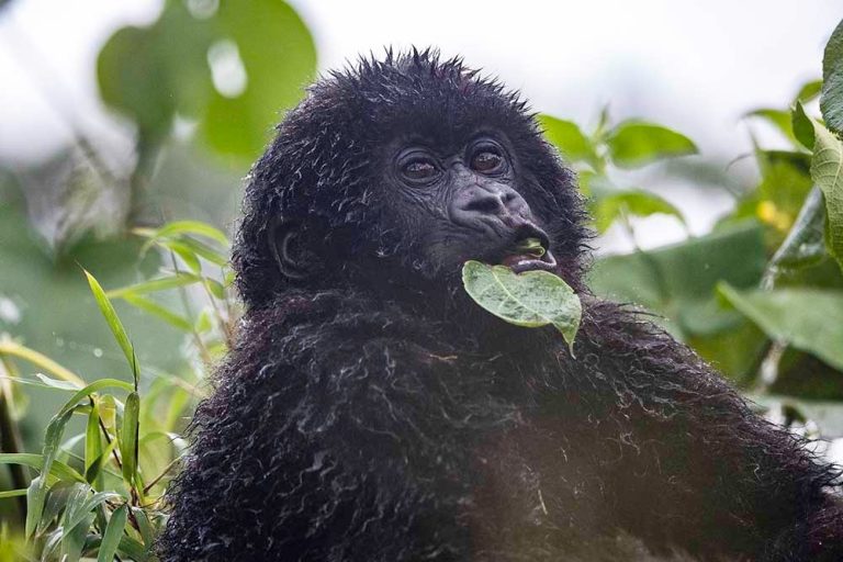
Mountain gorilla trekking is one of the region’s best-known wildlife experiences. Visitors can book authorized treks in Volcanoes National Park in Rwanda or Mgahinga Gorilla National Park in Uganda.
Gorilla trekking requires a separate permit and follows specific conservation rules. It should not be confused with climbing Mount Muhabura, as the activities have different routes, requirements, and costs.
Golden Monkey Tracking
Golden monkey tracking is available in designated areas of the Virunga region, including Volcanoes National Park and Mgahinga Gorilla National Park.
These lively primates inhabit forested areas, particularly bamboo zones. Guided tracking offers an opportunity to observe their behavior and learn about the conservation of their habitat.
Birdwatching
The Virunga region is an attractive destination for birdwatchers because its different elevations and vegetation zones support diverse birdlife. Guided walks can help visitors identify local forest birds and species associated with the Albertine Rift.
Cultural Experiences
Travelers can also learn about the traditions and daily lives of communities surrounding the volcanoes. Depending on the location, organized cultural visits may include traditional food, crafts, music, storytelling, and community-led tourism activities.
Mount Muhabura Hiking Permits and Costs
A hiking permit is required for an authorized ascent of Mount Muhabura. Fees and booking procedures depend on whether you hike from the Rwandan or Ugandan side.
In Rwanda, permits are arranged through the relevant tourism authorities for Volcanoes National Park. In Uganda, visitors should contact the Uganda Wildlife Authority or the park’s authorized booking channels.
The total cost may depend on the visitor category and whether services such as transportation, accommodation, equipment rental, or porters are included. Confirm the current permit price directly with the relevant authority before making payment, as published rates can change.
Best Time to Hike Mount Muhabura
The relatively drier periods, generally from June to August and December to February, are often favorable for hiking Mount Muhabura. During these months, trails may be less muddy and visibility may be better, although mountain weather can change quickly.
June to August
These months are generally suitable for travelers seeking drier hiking conditions. They can be a good choice for outdoor activities, but visitors should still prepare for cold temperatures, rain, and mist at higher elevations.
December to February
This is another commonly preferred period for mountain hiking. Conditions can be more favorable for walking, although weather varies from year to year.
March to May and September to November
These periods can bring wetter conditions, which may make steep trails slippery and increase the difficulty of the ascent. Hiking may still be possible, but travelers should check the forecast and follow the advice of park authorities.
Regardless of the season, confirm trail access and the day’s conditions before setting out.
How to Get to Mount Muhabura
Mount Muhabura can be approached from Rwanda or Uganda, but the starting point and transport arrangements depend on which country’s authorized hiking route you choose.
Getting There from Rwanda
Travelers typically make their way to the Kinigi area near Volcanoes National Park, in northern Rwanda. From Kigali, the journey generally takes a few hours by road, depending on traffic and conditions.
Confirm your reporting time, transport to the trailhead, and hiking arrangements with the park or your tour operator before departure.
Getting There from Uganda
On the Ugandan side, travelers usually reach Kisoro in southwestern Uganda before proceeding to Mgahinga Gorilla National Park. Road journeys from Kampala are considerably longer than journeys from Kigali, while domestic flight options may be available depending on schedules.
Allow enough time to reach your accommodation and confirm your hike with the relevant park authorities.
Important: A hike on one side of the border does not automatically authorize entry into the other country. Follow official border procedures and use only the designated hiking route approved by the relevant authorities.
What to Pack for Mount Muhabura Hiking
Because Mount Muhabura is high, steep, and exposed to changing weather, packing the right equipment is essential.
Recommended items include:
-
Waterproof hiking boots with good grip.
-
A waterproof rain jacket and rain trousers.
-
Warm layers, such as a fleece or sweater.
-
Long hiking trousers and long-sleeved shirts.
-
A daypack with drinking water and energy-rich snacks.
-
Hiking poles or a walking stick.
-
Gardening gloves for added grip where appropriate.
-
Sunscreen, sunglasses, and a hat.
-
Insect repellent.
-
A first-aid kit and any necessary personal medication.
-
A fully charged phone and power bank.
-
A camera or binoculars for scenery and birdwatching.
-
Extra socks and a change of clothes.
Pack according to the park’s current guidance, and avoid carrying unnecessary weight on the ascent.
Safety Tips for Hiking Mount Muhabura
To make your hike safer and more enjoyable:
-
Book an authorized guide: Follow the rules of the park where you will hike.
-
Start early: Follow the official reporting time and planned hiking schedule.
-
Prepare physically: Practice uphill walking and longer hikes before your trip.
-
Stay hydrated: Drink water regularly and take appropriate snacks.
-
Dress in layers: Conditions can change significantly as you gain elevation.
-
Respect your limits: Do not push yourself if you experience severe fatigue or symptoms of altitude-related illness.
-
Follow ranger instructions: Do not leave the designated trail or approach wildlife.
-
Check current conditions: Confirm weather, trail access, and security arrangements before traveling.
Frequently Asked Questions About Mount Muhabura
1. How high is Mount Muhabura?
Mount Muhabura rises approximately 4,127 meters (13,540 feet) above sea level, making it one of the highest volcanoes in the Virunga Mountains.
2. Where is Mount Muhabura located?
Mount Muhabura is situated on the border between Rwanda and Uganda. It is associated with Volcanoes National Park in Rwanda and Mgahinga Gorilla National Park in Uganda.
3. How long does it take to hike Mount Muhabura?
The hike generally takes a full day. The exact duration depends on the route, weather, trail conditions, and the pace of the group.
4. Is Mount Muhabura difficult to climb?
Yes. Its steep slopes, high elevation, and demanding ascent make it a challenging hike. Good physical fitness, appropriate equipment, and an authorized guide are recommended.
5. Is there a crater lake on Mount Muhabura?
Yes. A small crater lake lies near the summit and is one of the mountain’s main natural attractions.
6. Can I hike Mount Muhabura from Rwanda and Uganda?
Hiking arrangements are available through authorized park services on either side, subject to current access conditions. Permits and procedures depend on the country and route you choose.
7. What is the best time to hike Mount Muhabura?
June to August and December to February are generally favorable periods because conditions are often relatively drier. However, mountain weather is unpredictable, so check current forecasts before hiking.
Conclusion
Mount Muhabura is a remarkable destination for adventure travelers exploring the Virunga Mountains. Its steep volcanic slopes, summit crater lake, high-altitude vegetation, and panoramic views make it one of the region’s most rewarding hiking challenges.
Whether you approach the mountain from Rwanda or Uganda, planning ahead is essential. Arrange the appropriate permit, prepare for a full day of strenuous hiking, and follow the guidance of authorized park staff.
For travelers combining adventure with wildlife experiences, Mount Muhabura can be an excellent addition to a broader itinerary featuring gorilla trekking, golden monkey tracking, birdwatching, and cultural activities in the Virunga region.